This article reviews prominent water detection indices - NDWI, MNDWI, NDMI, AWEI, and WRI - highlighting their distinct formulas, applications, and limitations in remote sensing analysis.
NDWI
Normalized Difference Water Index
Developed by McFeeters (1996) to identify open water bodies using spectral reflectance differences:
Formula:
NDWI = (NIR - Green) / (NIR + Green)
Principle:
- High reflectance in Green band
- Strong absorption in Near-Infrared (NIR) band
- Maximizes contrast between water and vegetation/soil
MNDWI
Modified Normalized Difference Water Index
Proposed by Xu Hanqiu (2005) to address NDWI's limitations in urban areas:
Formula:
MNDWI = (Green - SWIR) / (Green + SWIR)
Advantages over NDWI:
- Suppresses urban building interference
- Enhances subtle water features (e.g., suspended sediments)
- Distinguishes water from shadows
- Higher accuracy in built-up areas
Limitations:
- Less effective for shallow/turbid waters
- Challenging in fragmented aquatic environments
NDMI
Normalized Difference Moisture Index
Created by Gao (1996) for vegetation water content monitoring:
Formula:
NDMI = (NIR - SWIR) / (NIR + SWIR)
Applications:
- Crop water stress detection
- Drought monitoring
- Wildfire risk assessment
- Vegetation health evaluation
Value Range:
- High values (+1): Water-sufficient vegetation
- Low values (-1): Water-stressed vegetation/non-vegetated areas
AWEI
Automated Water Extraction Index
Introduced by Feyisa et al. (2014) to overcome urban shadow and reflectance challenges:
Variations
AWEI_nsh (non-shadow suppression):
math
AWEI_{nsh} = 4 × (Green - SWIR1) - (0.25 × NIR + 2.75 × SWIR2)
Bands: Green (B3), SWIR1 (B6), NIR (B5), SWIR2 (B7)
AWEI_sh (shadow suppression):
math
AWEI_{sh} = Blue + 2.5 × Green - 1.5 × (NIR + SWIR1) - 0.25 × SWIR2
Bands: Blue (B2), Green (B3), NIR (B5), SWIR1 (B6), SWIR2 (B7)
Advantages:
- Superior urban shadow resistance
- Higher automation in water extraction
- Robust cross-scenario performance
WRI
Water Ratio Index
Uses visible-NIR/SWIR ratios for water detection:
Formula:
WRI = (Green + Red) / (NIR + SWIR)
Interpretation:
- High values (>1): Water bodies
- Moderate values (~1): Moist vegetation/soil
- Low values (<1): Dry land features
Applications:
- Water body mapping
- Vegetation moisture assessment
- Flood inundation delineation
Summary
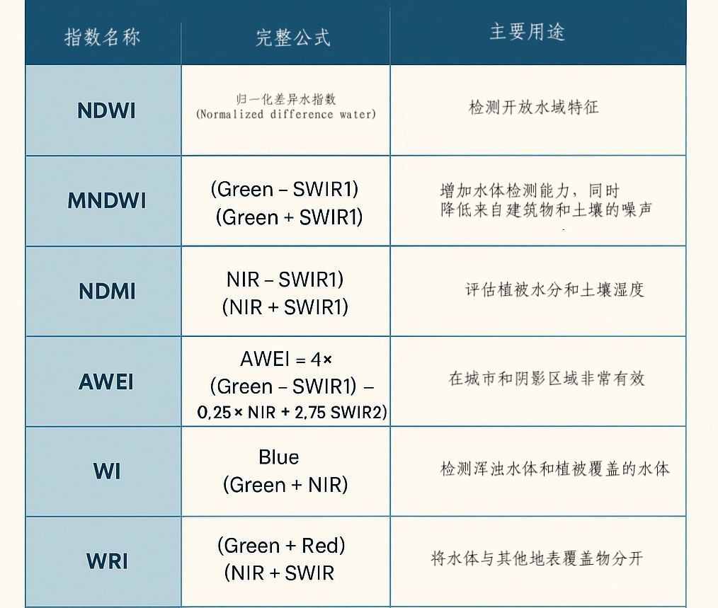
Figure: Comparative characteristics and application scenarios of major water indices