When our frontend team requested updated administrative division codes, I leveraged the 2024 national standard vector map dataset (Approval No. GS(2024) 0650) shared in our previous article. This official dataset contains accurate administrative codes within its attribute tables, making it ideal for extraction.

Exporting Attribute Tables in QGIS
Step-by-Step Process
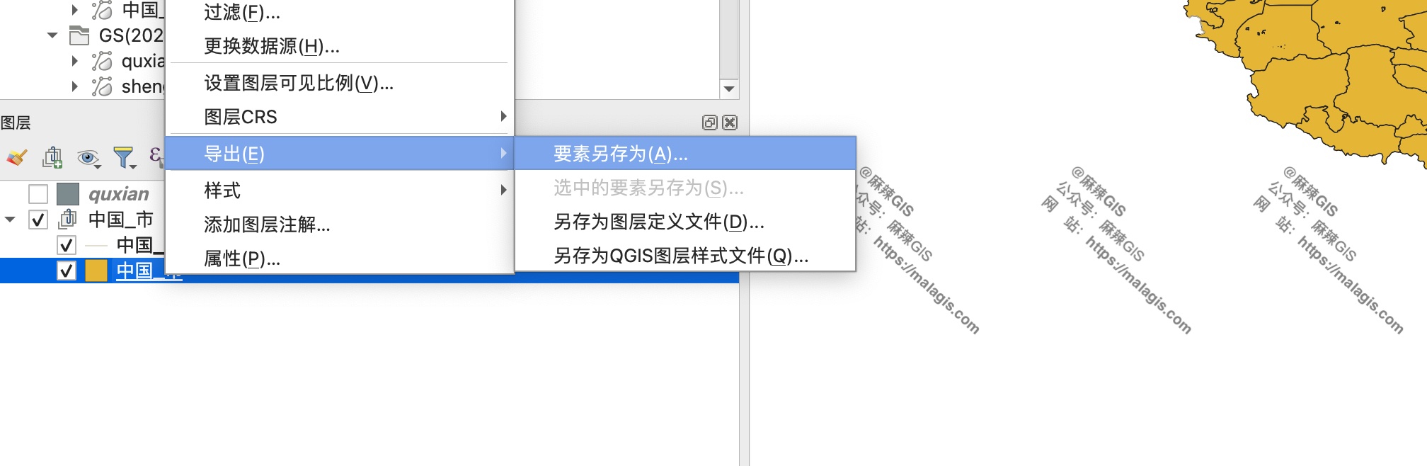
- Load the administrative boundary layer
- Right-click the layer in Layers Panel
- Select
Export → Save Features As...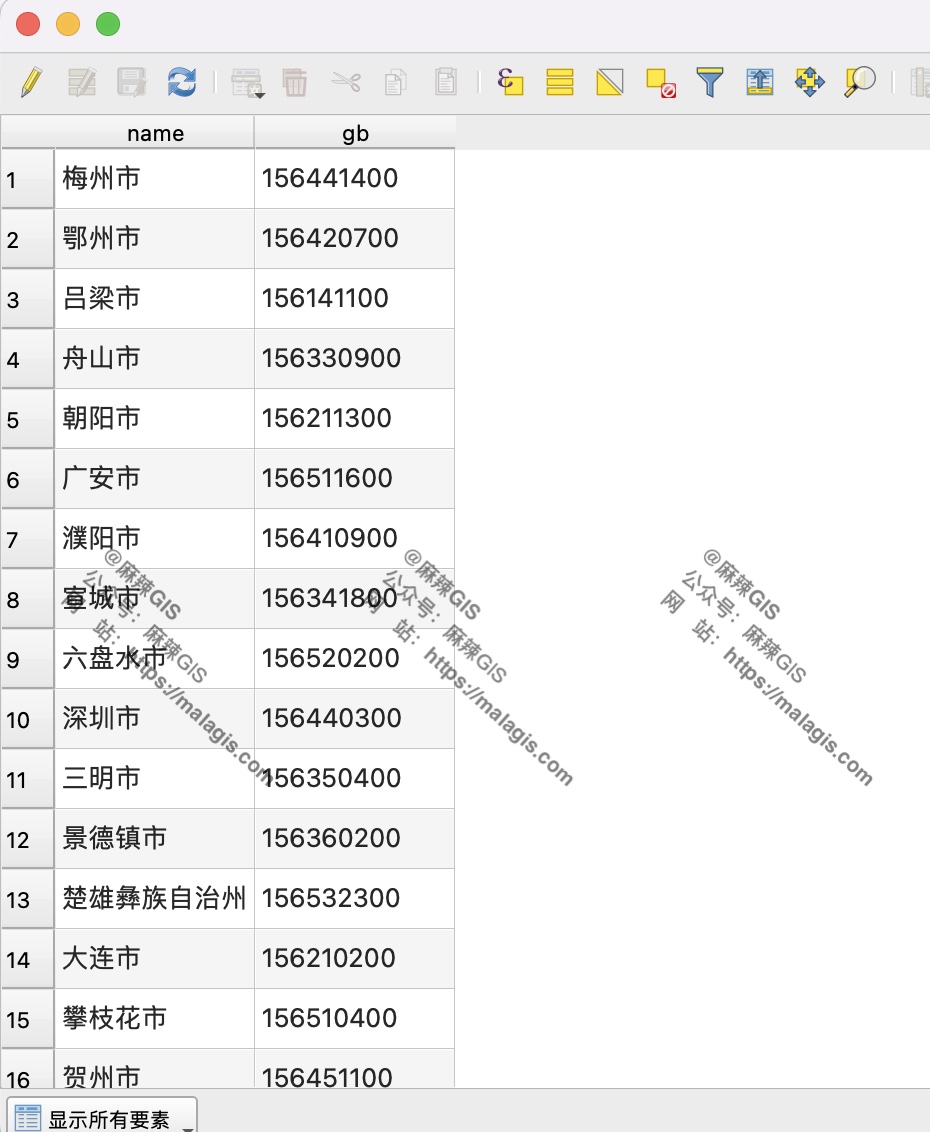
In the export dialog:
- Set Format to
MS Excel(.xlsx) - Uncheck "Export geometry" to export attribute-only data
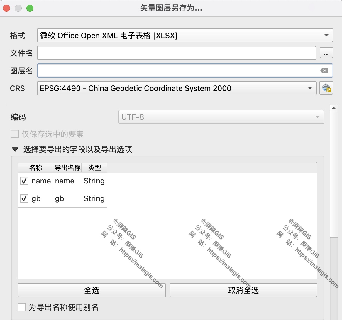
- Set Format to
- Specify output path and execute
Data Utilization
The exported Excel file contains structured administrative codes ready for:
- Database ingestion
- JSON conversion for web applications
- Direct API integration
Preferred Format Recommendation: For programmatic processing, export as CSV for faster parsing in Python/NodeJS environments: 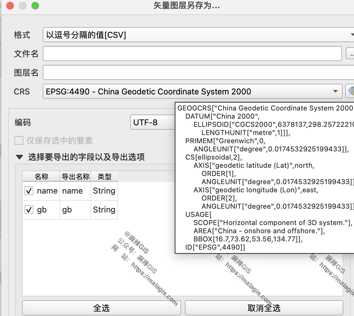
Key Benefits
- Data Integrity: Maintains official GS(2024)0650 standard codes
- Efficiency: Avoids manual code compilation
- Flexibility: Supports multiple output formats for different use cases