Recently, someone in the Malagis GIS group was looking for historical maps of Chinese dynasties. While a friend from Qingdao shared some high-resolution scanned maps, I remembered seeing an online historical map service maintained by an institute in Taiwan. After asking GPT, I found it again. If you're interested in historical geography, this is a valuable resource.
Service Overview
Chinese Civilization Temporal-Spatial Infrastructure (WMTS Service)
Service URL: https://gis.sinica.edu.tw/ccts/wmts
This service is provided in Traditional Chinese, but the interface and content are easy to understand. The map collection includes:
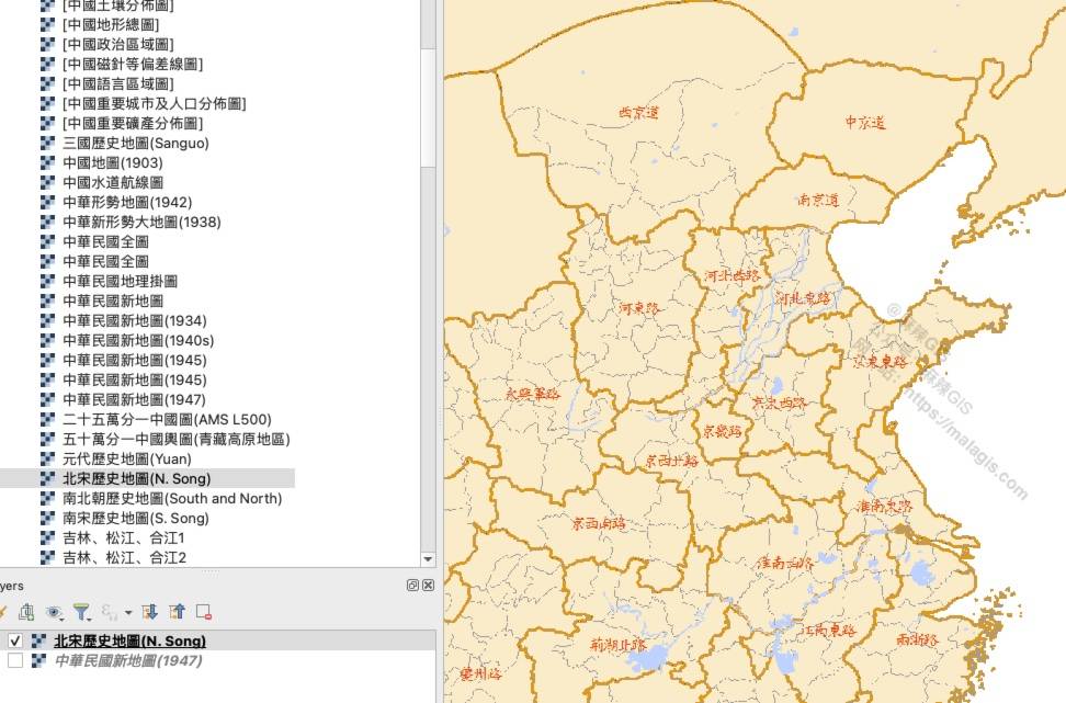
- Historical dynasty maps (Qin, Han, Tang, Song, Yuan, Ming, Qing, etc.)
- Detailed topographic maps (e.g., 1:50,000 and 1:100,000)
- Thematic maps such as population, languages, minerals, soil, terrain, and more
- Maps from different historical periods (Spring and Autumn, Warring States, Republic of China, etc.)
A full list of layers is available at the service URL and includes more than 100 layers.
Loading the WMTS in QGIS
Once you have the WMTS service link, it's easy to view the data in QGIS or ArcGIS. Here's how to do it in QGIS.
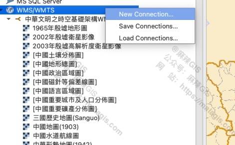
- In the Browser Panel, find WMS/WMTS.
- Right-click it and choose New Connection.
- In the pop-up dialog, paste the WMTS URL:
https://gis.sinica.edu.tw/ccts/wmts
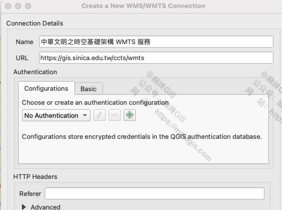
- Click OK. You will now see the WMTS service in the browser panel.
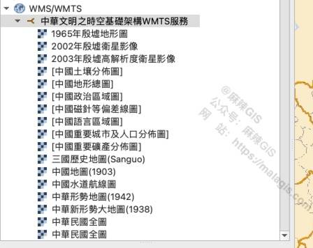
- Double-click the layer you want to load. For example, here is the 1947 Republic of China map:

Notes
From testing, the service performs well overall. However, some maps may not load completely—for instance, the Western Han map had missing tiles.

If you have more historical map resources, feel free to share them!