MalaGIS

Sharing GIS Technologies, Resources and News.

Unlocking Global Insights: Google's AlphaEarth Foundations and Satellite Embedding Dataset Revolutionize Geospatial Analysis

Google has officially launched AlphaEarth Foundations, a PB-scale AI model for integrating satellite data, accompanied by a groundbreaking 64-dimensional Satellite Embedding Dataset. This innovation distills multi-year, multi-satellite observations into a single 10m × 10m pixel, compressing dozens of data sources – including satellite imagery, radar, elevation, and climate data – into unified 64-dimensional "information capsules". This fundamentally redefines geospatial analysis methodologies.

more >>

Comparative Analysis of Landsat 9 and Sentinel-2 Satellite Parameters

This article contrasts the core technical specifications of Landsat 9 and Sentinel-2, key Earth observation satellites for environmental monitoring.

Mission Overview

Landsat 9

  • Launch Date: September 27, 2021
  • Agencies: NASA and USGS
  • Objective: Continuation of long-term Earth monitoring for environmental change, land use, and climate studies

more >>

NASA Landsat's Alphabet Fun: Spell Your Name with Satellite Imagery

While browsing NASA resources, I discovered an intriguing tool called "Your Name In Landsat". This creative application transforms text into satellite imagery mosaics - a perfect diversion as we approach the Mid-Autumn Festival.


Example output: "malagis" spelled with Landsat imagery

more >>

Acquiring Global Satellite Orbit Data from UCS Database

Following our previous article 《「GIS Tutorial」Visualizing Global Satellites Online》, many readers inquired about accessing raw satellite data for custom visualizations. After extensive research, we've identified a reliable method to obtain comprehensive satellite orbital data.


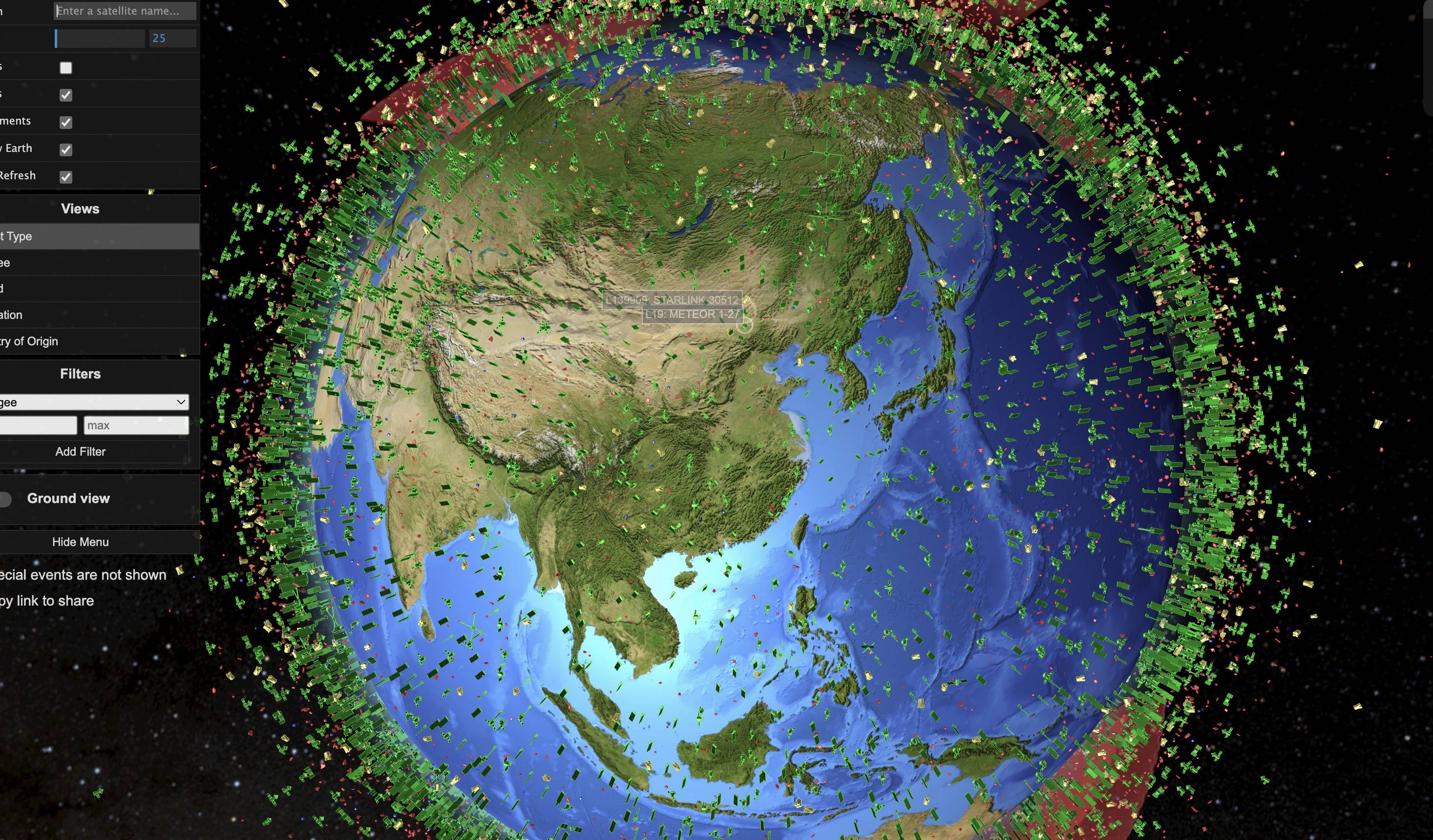
Reference visualization from the original platform

more >>

Real-Time Visualization Tool for Tracking Global Satellite Orbits

Following our previous article 《A WMTS Service for Historical Chinese Maps: How to Load in QGIS》, colleagues inquired about websites for querying global satellite parameters. Coincidentally, I recently discovered such a platform through video recommendations. The website remains operational and is shared here for relevant needs.

more >>

Copyright © 2020-2025 MalaGIS Drive by Typecho & Lingonberry Sitemap

Back to top