While reviewing flood reports, an unusual phenomenon caught my attention: Vietnamese ducks carried by floodwaters into Guangxi, China. This initially seemed geographically counterintuitive—Vietnam lies south of China, so why would floodwaters flow northward? Further investigation revealed fascinating hydrological realities.
Flood impact visualization
Geographic Clarification
My initial confusion stemmed from conflating Guangxi and Yunnan provinces. While Yunnan's Lancang River (Mekong) dominates southern border hydrology discussions, Guangxi's topography features distinct river systems flowing from Vietnam into China.
Hydrological Analysis
The Yong River (邕江), Nanning's mother river, receives floodwaters through two primary tributaries:
- Zuo River (左江): The main flood carrier
- You River (右江): Contributes minimally
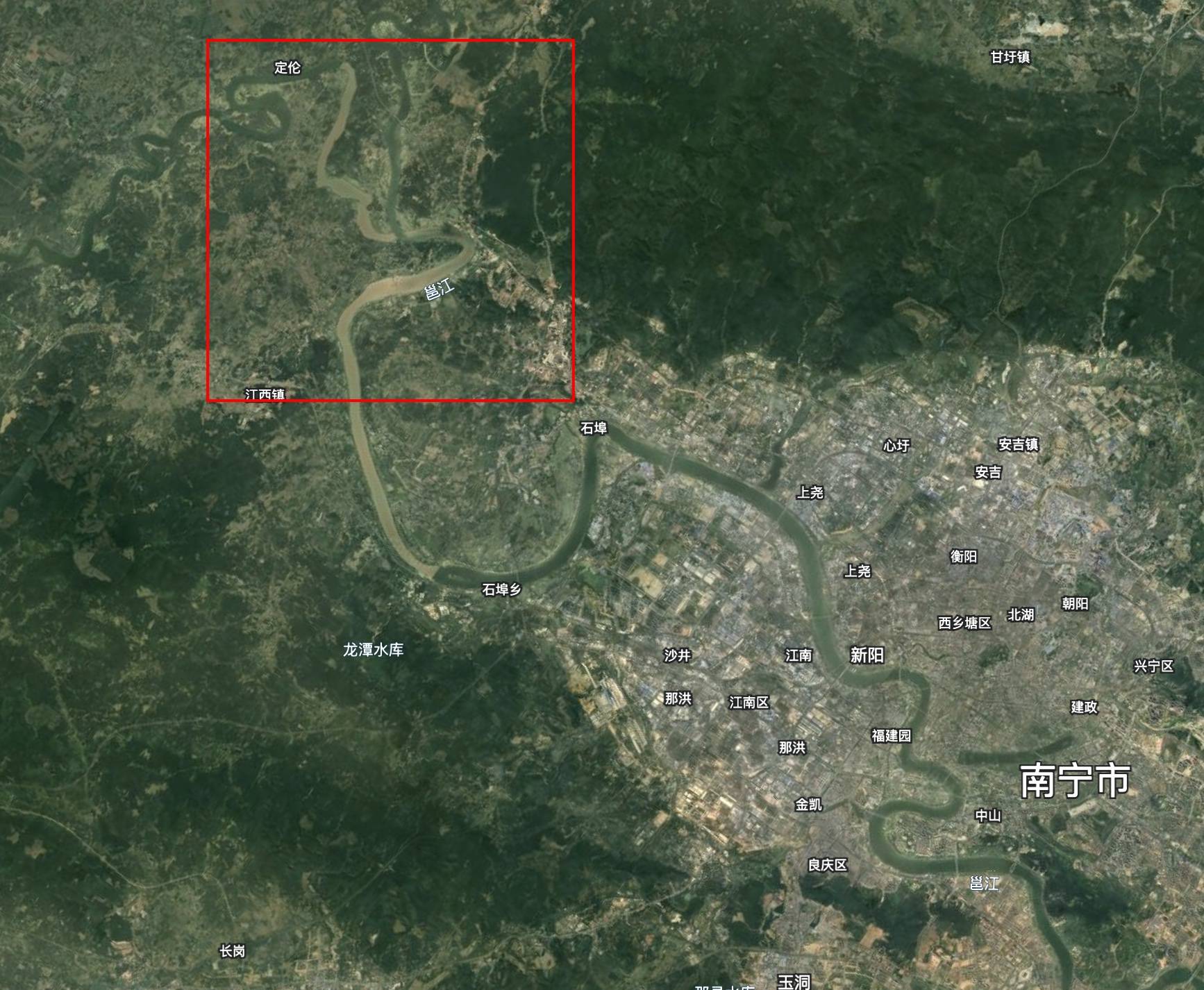
Yong River tributary system
Transboundary Water Sources
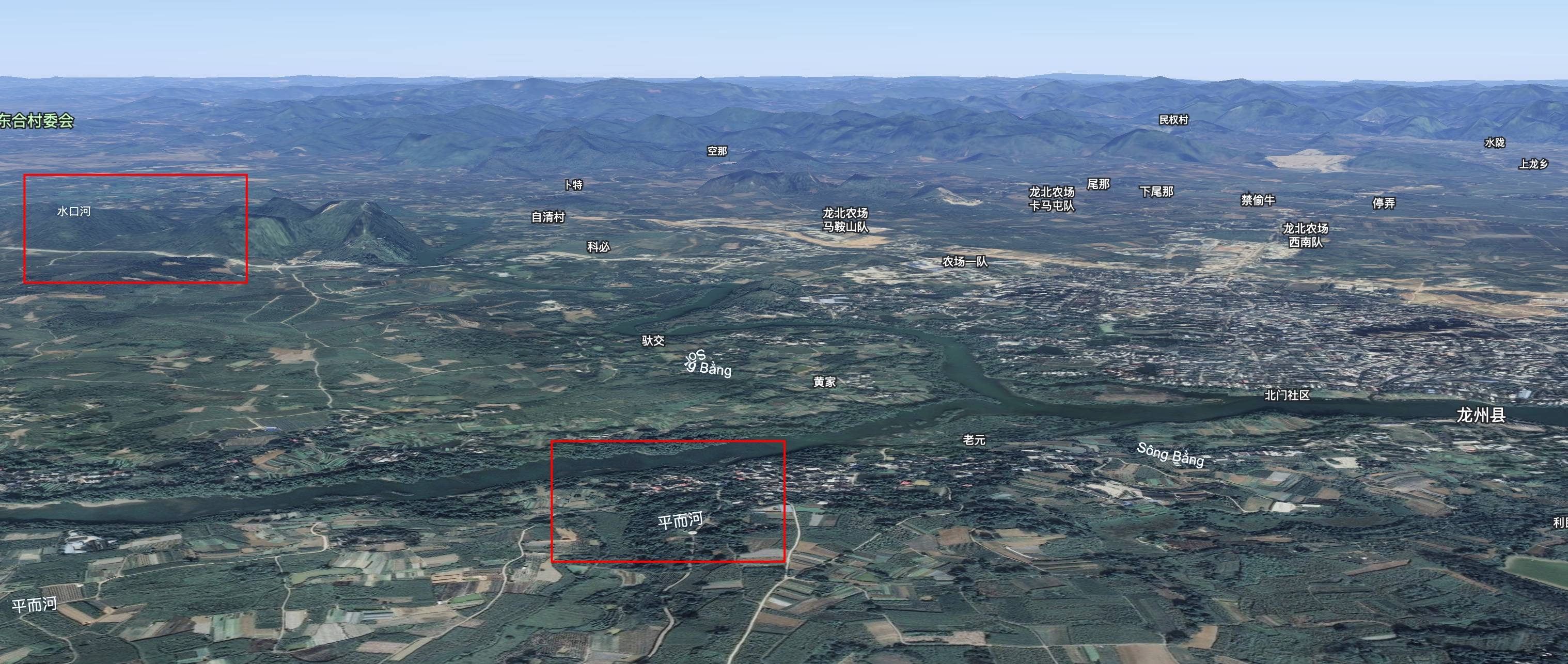
The Zuo River's headwaters originate in Vietnam:
Shuikou River (水口河):
- Rises in Napo County, Guangxi
- Flows southeast as Bằng Giang River through Cao Bằng Province, Vietnam
- Re-enters China at Shuikou Town, Longzhou County
Ping'er River (平而河)/Kỳ Cùng River:
- Known as Kỳ Cùng in Vietnam (historic site of the Lang Son Campaign)
- Crosses the border into Guangxi
Transboundary river network at Longzhou County
Hydraulic Principle
The fundamental mechanism is simple: water follows topographic gradients. DEM analysis confirms higher elevations in Vietnam's Cao Bằng Province compared to Guangxi's Chongzuo region:
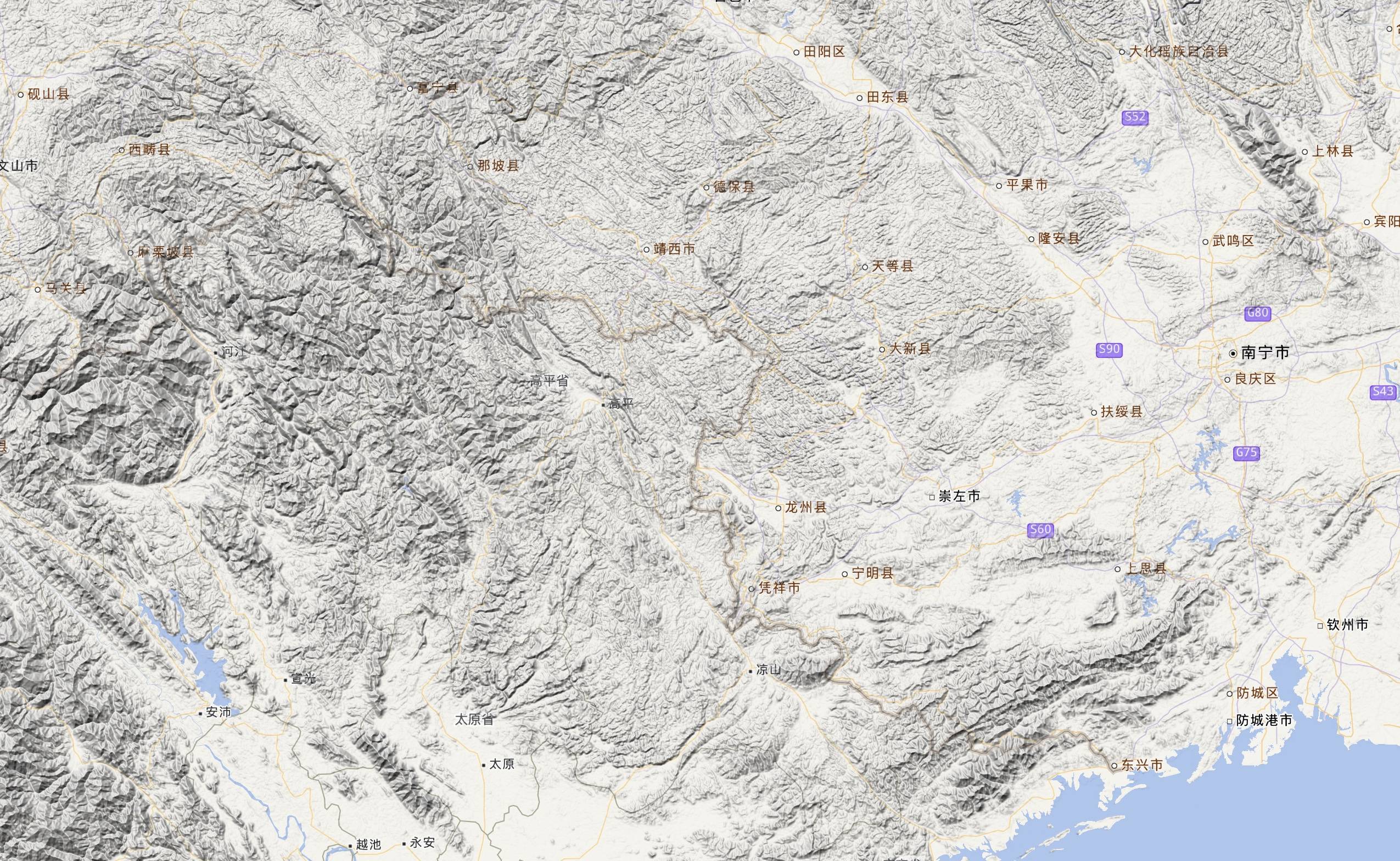
Elevation profile (Tianditu hillshade)
These Vietnamese-sourced waters ultimately join the Pearl River system before reaching the South China Sea.
Conclusion
This case exemplifies how localized topography overrides cardinal direction assumptions in hydrology. While textbooks emphasize south-to-north continental drainage patterns, micro-topography creates exceptions where northern flow becomes hydrologically inevitable.
Image Sources: Tianditu, Google Earth