Following our previous article on the https://malagis.com/gis-data-share-2010-2020-global-forest-age-distribution-gami-data.html, this guide demonstrates netCDF visualization techniques in QGIS, eliminating the need for specialized tools like IDL.
Method 1: Direct File Opening
Simply double-click the netCDF file in QGIS Browser: 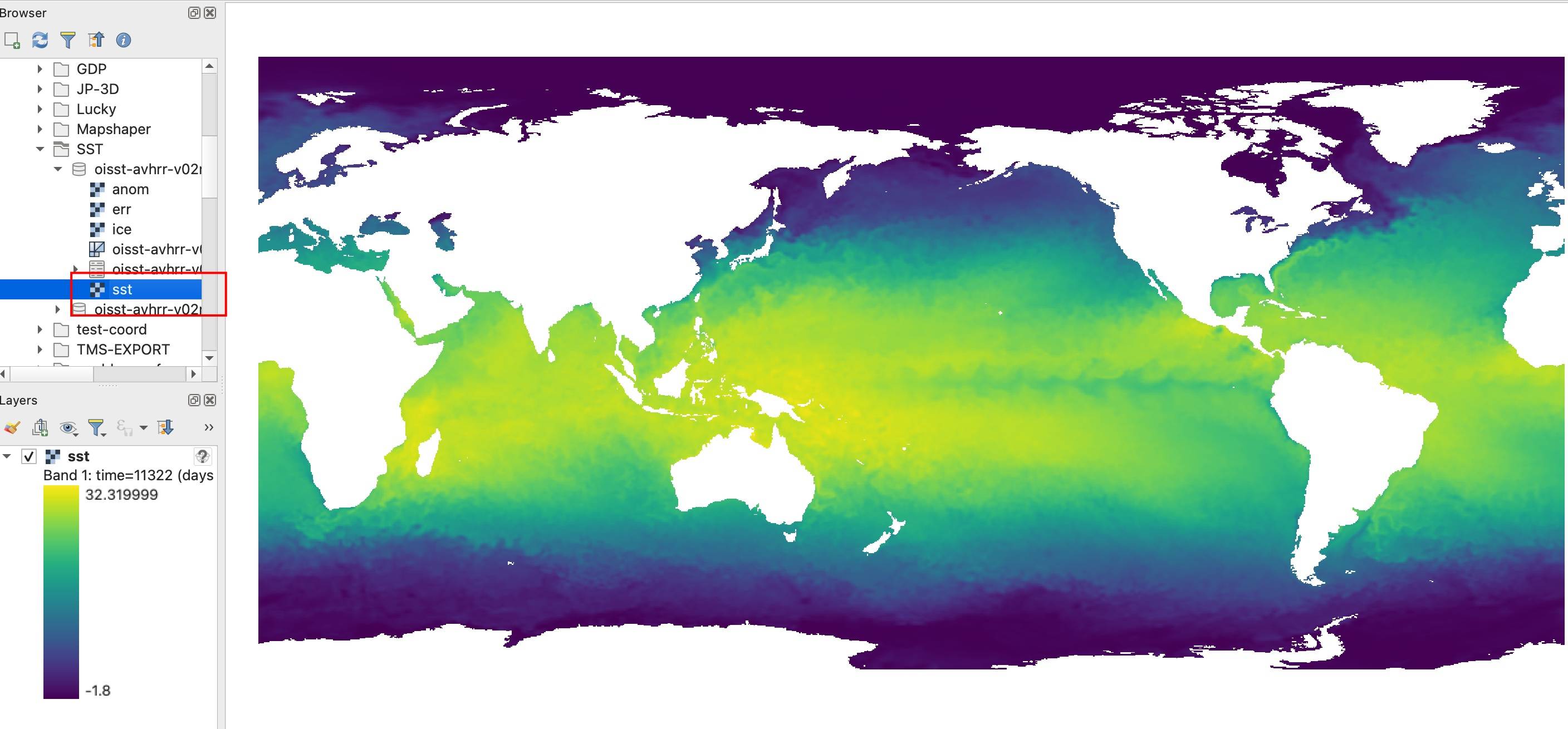
Method 2: Manual Layer Addition
- Navigate:
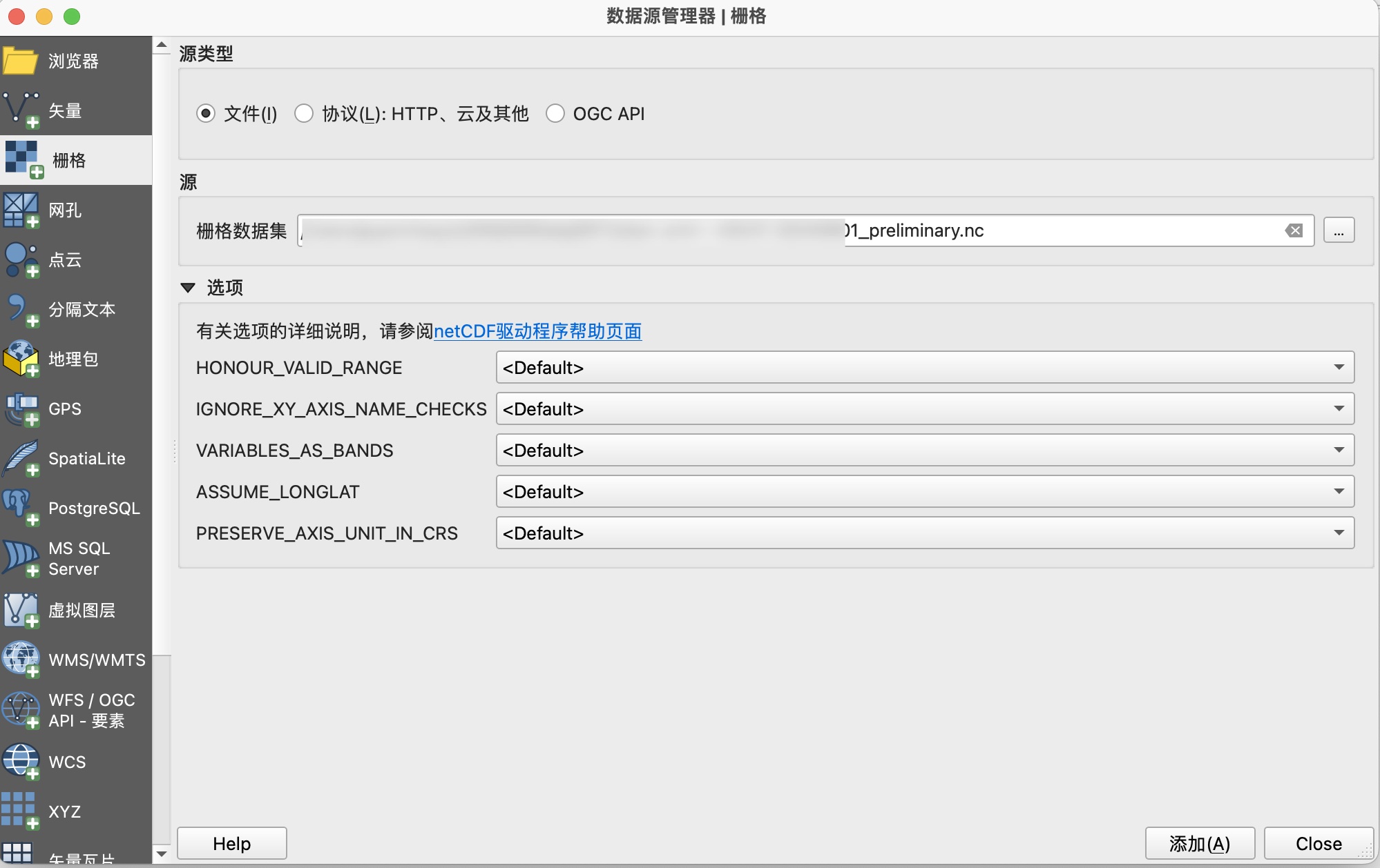
Layer → Add Layer → Add Raster Layer - Select netCDF file
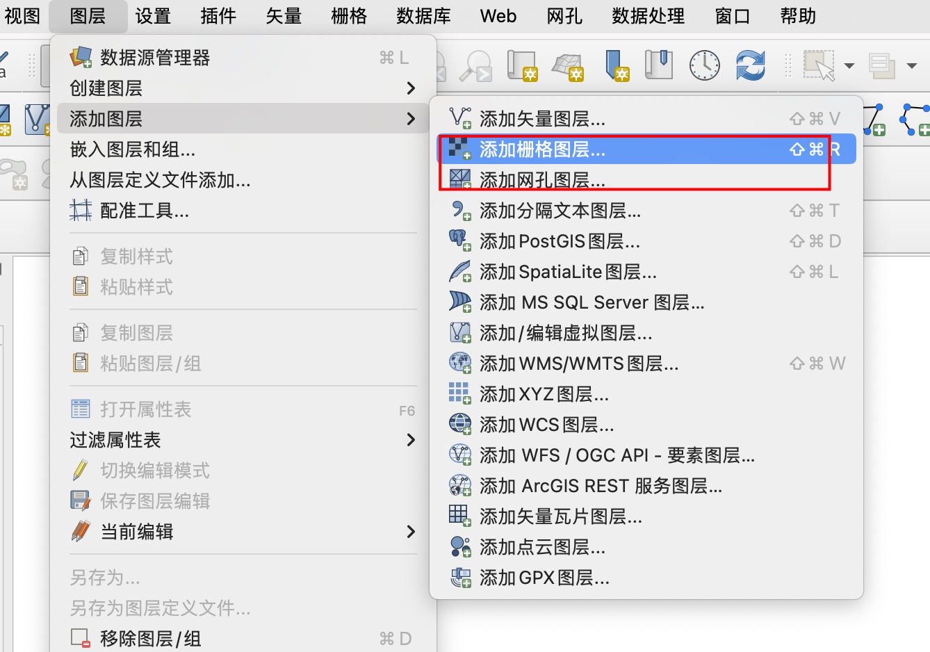
Alternative for unsupported files: Layer → Add Layer → Add Mesh Layer
Data Export
Convert to GeoTIFF for broader compatibility:
- Right-click layer →
Export → Save As - Select
GeoTIFFformat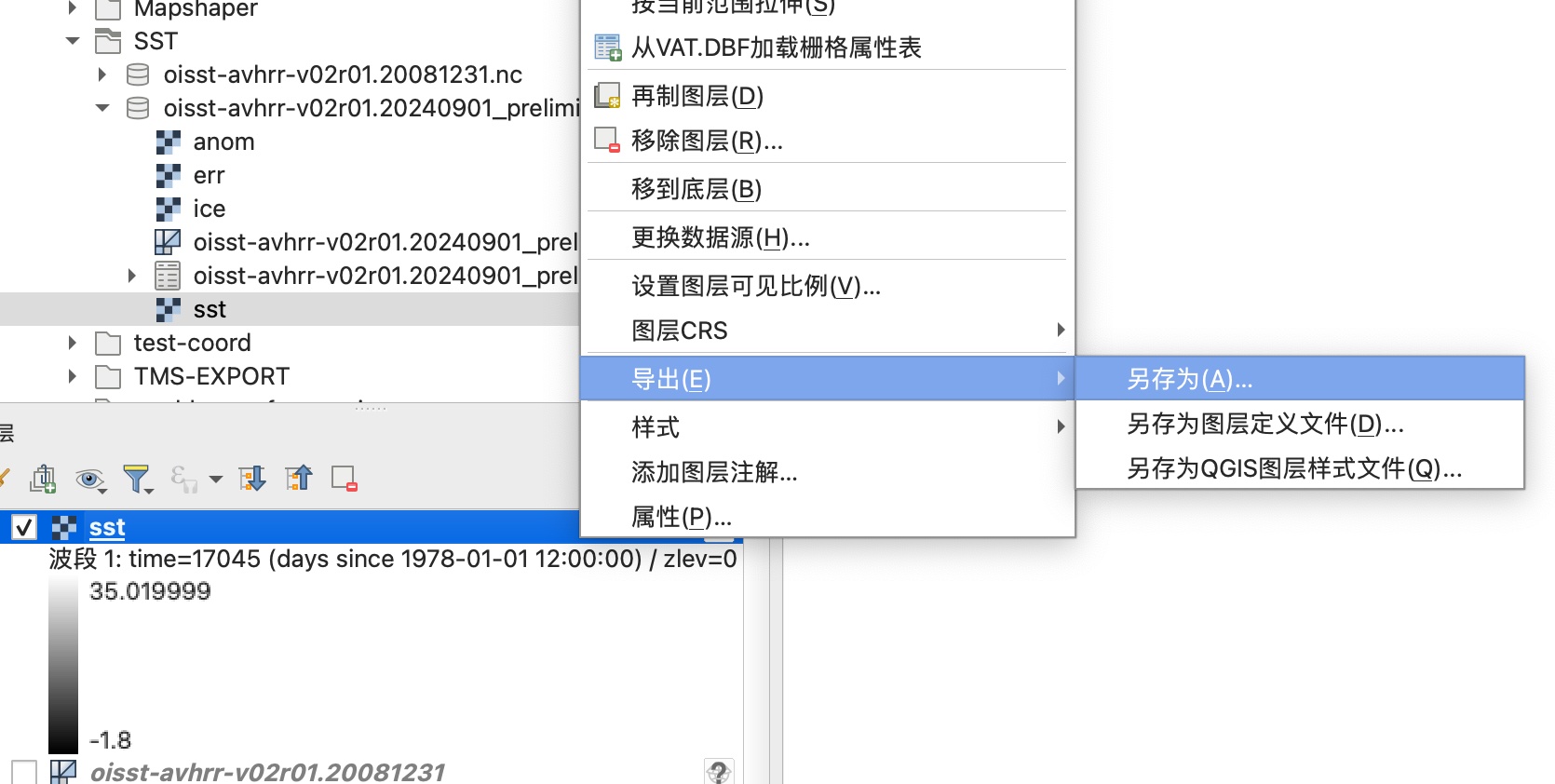
Common Issues & Solutions
1. "Invalid DataSource" Error
Diagnosis:
gdalinfo path/to/file.ncExpected output:
"the format is not a valid or recognized data source"
Solution (MacOS with MacPorts):
sudo port install gdal +netcdf2. Performance Lag
- Observed with large datasets like GAMI
- Potential causes: Hardware limitations or unoptimized GDAL drivers
Troubleshooting Tips
- Switch QGIS interface to English for error message accuracy
- Search English technical forums using exact error codes