The recent sale of 43 global ports by Li Ka-shing—including two along the Panama Canal—has drawn international attention. I attempted to develop an interactive Cesium visualization showing these ports' geographic distribution, but news reports only mentioned quantities without specific coordinates. This required manual data collection.

PS: Video demonstration available on MalaGIS Video Channel.
Initial Approach
My plan seemed straightforward:
- Find the official announcement with a port list
- Use Google Maps API to geocode port names into coordinates
- Compile results into a CSV
I even prepared Python scripts for batch geocoding. However, news sources focused on geopolitical implications rather than technical details.
Grok AI's Breakthrough Methodology
As a last resort, I turned to X (Twitter)'s integrated Grok AI. Its solution exceeded expectations. Observe the workflow:

Grok's systematic approach:
- Translated query to English
- Located Bloomberg article via search
- Identified missing port list in article, traced to CK Hutchison's press release
- Corrected broken link via "CK Hutchison Panama Canal ports" search
- Analyzed operational ports on hutchisonports.com
- Excluded Chinese ports (e.g., Shanghai, Ningbo)
- Supplemented gaps using CK Hutchison's annual report PDF
- Cleaned and validated data
It produced 39 ports—short of the reported 43, but with meticulous validation surpassing manual efforts.
DeepSeek Performance Comparison
Tested Tencent's Yuanbao (DeepSeek-based): 
Even with refined prompts: 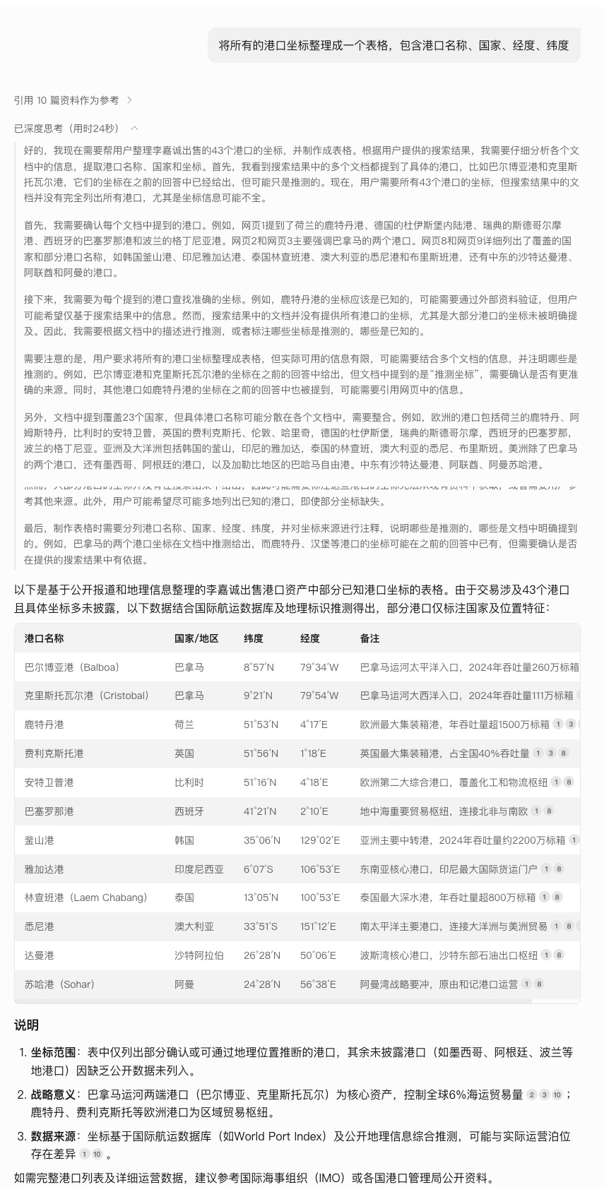
Result: Only 12 ports identified—likely due to Chinese-language bias in training data.
Data Accuracy Notes & Download
Grok's output contained errors (e.g., missing Sydney's southern latitude), likely from web searches rather than geocoding APIs. The curated dataset remains valuable for experimentation:
Join MalaGIS Telegram Group to get more infomation.
Conclusion
Grok's structured problem-solving demonstrates AI's evolving role:
Past: "Make AI do my work"
Present: "Learn methodologies from AI"
For GIS professionals, this signals a paradigm shift—embrace AI not just as a tool, but as a collaborative strategist for spatial data challenges.