Using Python within ArcGIS requires foundational Python knowledge. The following modules support Python integration:
(1) Python Window
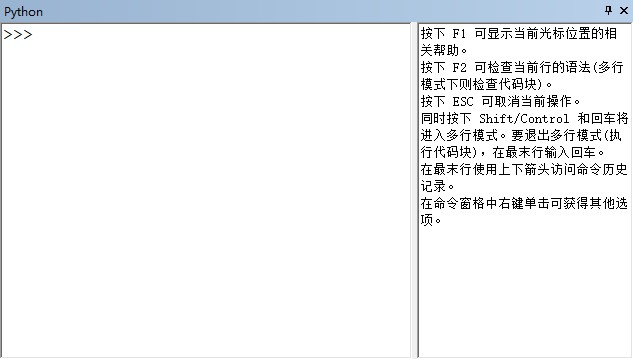
Implementation Steps:
- Import ArcPy:
import arcpy
- Execute commands directly:
arcpy.env.workspace = "C:/Data/Tongass"
arcpy.Clip_analysis("standb4", "clipcov", "standby_clip", "1.25")
Key Features:
- Default Workspace:
arcpy.env.workspacedefines processing locations, enabling layer access by name without full paths - Tool Drag-and-Drop: Drag tools into the window to auto-generate corresponding code
- Path Retrieval: Copy layer paths directly from Catalog

- Built-in Help: Right-click tools for parameter documentation (Chinese language pack recommended)
- Code Completion: Real-time tooltips display parameters and descriptions


(2) Field Calculator
Execute Python scripts for field operations (e.g., renaming fields, calculating geodesic areas):

(3) Model Builder
Embed Python scripts to extend functionality:
- Incorporate custom Python tools
- Call scripts within Calculate Field
import arcpy

input = arcpy.GetParameterAsText(0)
clip_features = arcpy.GetParameterAsText(1)
output = arcpy.GetParameterAsText(2)
arcpy.Clip_analysis(input, clip_features, output)

Note: Custom script tool creation will be detailed in future updates.
Leave a Comment