Recently, while testing OSGB data and related software, I explored using ArcGIS Pro for this purpose. After successful verification, this article documents the specific workflow.
Required Tools
- ArcGIS Pro 3.0/3.1 (Other versions & ArcMap untested)
- Sample oblique photography dataset
Step 1: File Conversion
ArcGIS Pro does not natively support opening OSGB files. Use the following geoprocessing tool:
- Navigate to Analysis → Tools
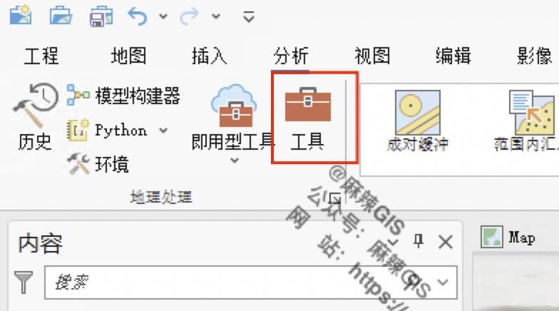
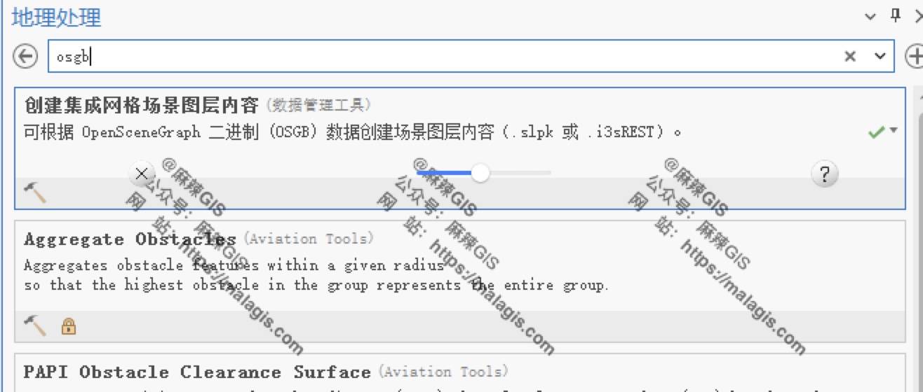
- Search for
osgbin the Geoprocessing pane - Select Create Integrated Mesh Scene Layer Content
Configure parameters:
- Input Folder: OSGB data directory
- Output File: SLPK format (ArcGIS Pro compatible)
- Metadata File:
metadata.xmllocation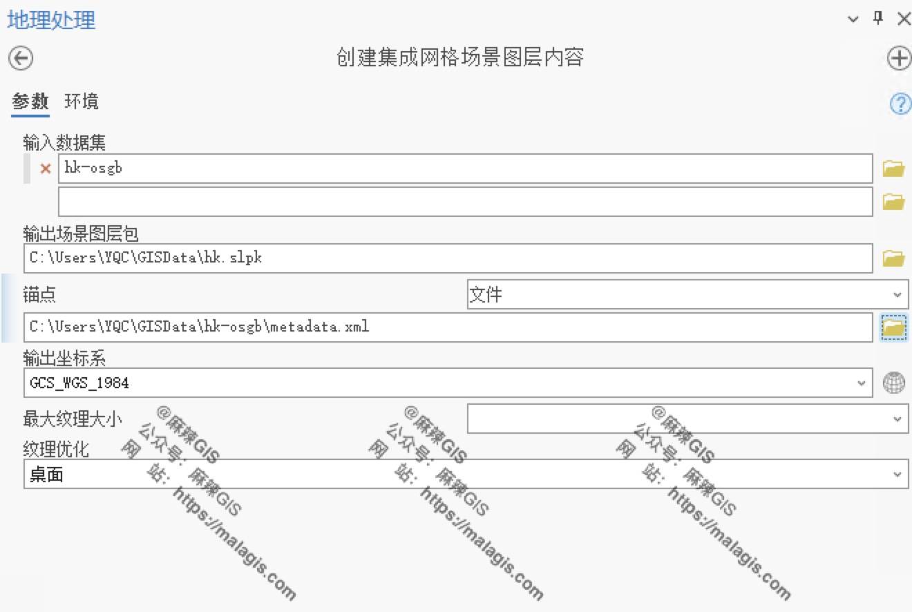
- Click Run
Step 2: Load SLPK Data
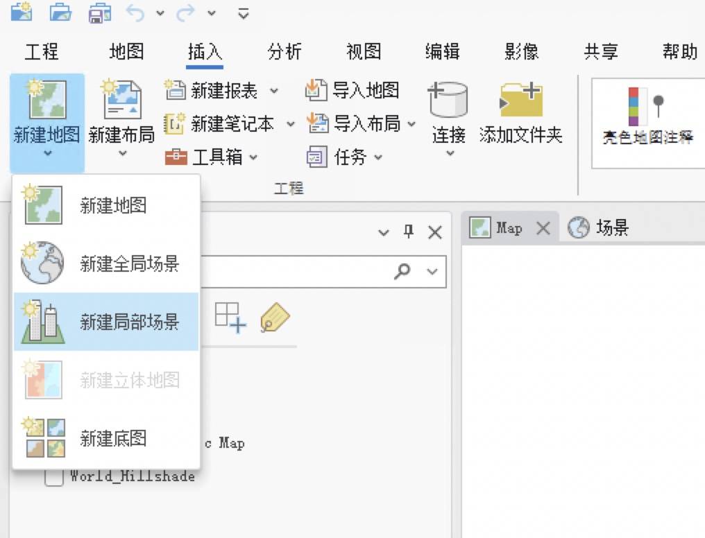
- Create a global scene: Insert → New Map → New Global Scene
- Add data: Select the converted SLPK file
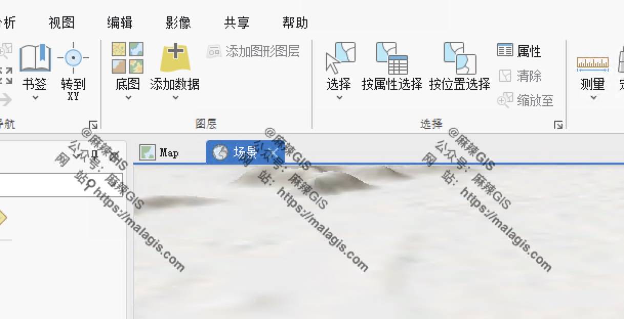
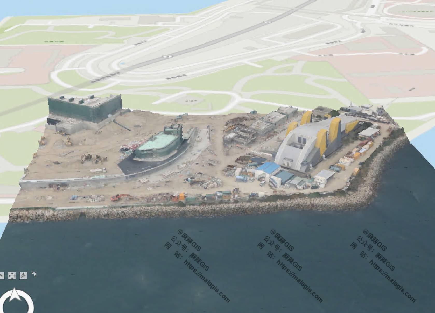
- Final rendered result:
Next Steps
- Where to obtain sample oblique photography datasets?
- What alternative software opens OSGB files?
These topics will be covered in upcoming articles.