 GIS Tutorial
Cesium Mars: A Unified High-Precision Digital Base for Mars Visualization and Simulation
Last year, our team introduced how to load lunar datasets in Cesium. Now, one year later, Cesium has...
GIS Tutorial
Last year, our team introduced how to load lunar datasets in Cesium. Now, one year later, Cesium has...
 GIS Tutorial
In the previous article titled "Displaying Selected Layer Count in QGIS with PyQGIS - MalaGIS", the ...
 GIS Tutorial
Preface: This article is compiled based on the author's experience with internet mapping services. W...
 GIS Tutorial
When working with numerous layers in QGIS, it is often necessary to select multiple layers simultane...
 GIS Tutorial
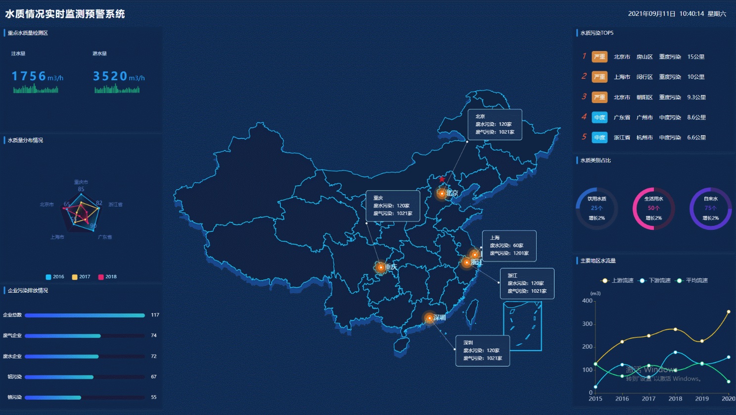
Recently, I was assigned another GIS dashboard project. My manager asked me to research the mainstre...
 GIS Tutorial
Yesterday, someone in a group shared a map of China's 2024 birth rate, which looked quite interestin...
 GIS Tutorial
Recently, many have asked why the China National Standard Map Service doesn’t offer SHP format downl...
 GIS Tutorial
Remote sensing imagery is crucial for global monitoring but often limited by sensor spatial resoluti...
 GIS Tutorial
Google has officially launched AlphaEarth Foundations, a PB-scale AI model for integrating satellite...
 GIS Tutorial
In the previous article "Discover Landsat's New Tool: Turning Your Name into Artistic Maps", I intro...
Copyright © 2020-2026 MalaGIS Drive by Typecho & Lingonberry Sitemap