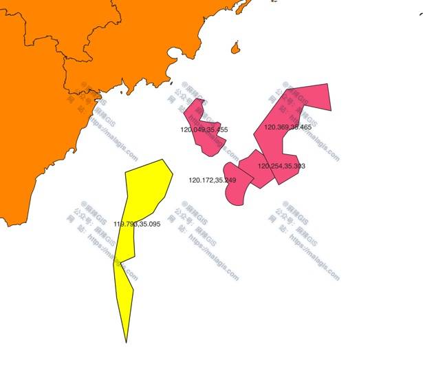
When working with large SHP boundary files, exporting coordinates of specific district boundaries to TXT is straightforward in QGIS. Here are three approaches:
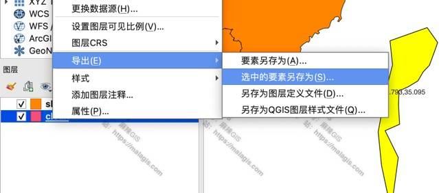
Method 1: GeoJSON Export
- Open SHP file and select target feature
- Right-click layer → Export → Save Selected Features As
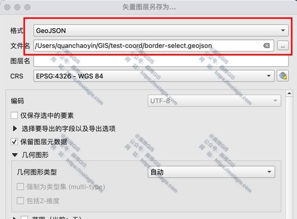
- Set format to GeoJSON and specify output path
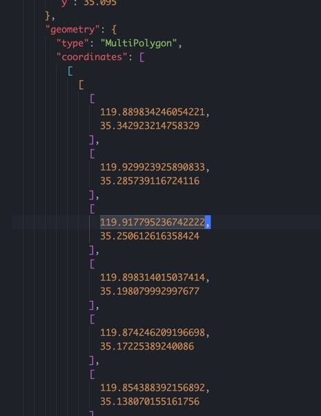
- Open exported GeoJSON in text editor and copy coordinates to TXT
Method 2: AS_XY (Limited Compatibility)
Note: Failed on macOS QGIS 3.28 LTS
- Follow Method 1 steps
- Set format to CSV with geometry option AS_XY

Result: Only exports attribute table without geometry
Method 3: WKT Export
- Follow Method 1 steps
- Set format to CSV with geometry option AS_WKT
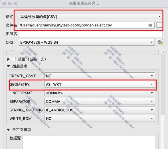
- Output contains Well-Known Text representation:

Suitable for coordinate extraction but requires parsing