Since U.S. President Donald Trump's executive order on his first day in office renamed the Gulf of Mexico to the "Gulf of America," the ripple effects have begun to spread. Recent reports indicate that major map service providers like Google Maps have already followed suit. But how does this change affect GIS professionals in China, and how should we respond? This article provides a brief analysis.
Updates from International Map Services
After reviewing services like Google Maps, Bing Maps, OpenStreetMap, and Cesium, here’s a summary of how each platform is handling the name change.
Google Maps
Google Maps was one of the first to react. Here's how it looks now:
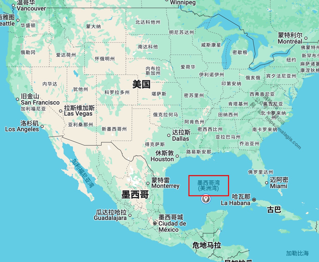
The label appears as “Gulf of Mexico (Gulf of America)”. However, Google applies regional variations. For example, in the U.S.:

And in Mexico:

This localized approach seems reasonable—it complies with regional laws and expectations without forcing a global rename.
Note: The above results were obtained using IPs from different regions and may vary.
Apple Maps
Although some online sources claimed Apple had updated the name, testing on an iPhone in China still shows “Gulf of Mexico”.

Anyone overseas can help verify this further.
Bing Maps
Bing Maps in China still labels the region as “Gulf of Mexico”:

However, in Cesium, which uses Bing Maps imagery, it already appears as Gulf of America:

OpenStreetMap
For open-source GIS users, OpenStreetMap has not changed the label—it still shows “Gulf of Mexico”.

Domestic Policy Response
On February 12, China’s Ministry of Foreign Affairs responded to the renaming action:
“We have noted the relevant reports and the reactions of certain countries. China has consistently opposed hegemony, bullying, and unilateralism in international relations,” said spokesperson Guo Jiakun.
So far, Chinese map services like Baidu and Amap have not changed the name.

Implications for the GIS Industry
Although domestic map services remain unchanged, GIS practitioners should still be aware of a few critical points:
1. Check Your Base Maps
If your GIS application targets domestic users, make sure your base maps and label sources are compliant. Many developers using Cesium may rely on the default Bing Maps layers. Both Bing Maps Road (ID: 4) and Bing Maps Aerial with Labels (ID: 7) now display Gulf of America, which could cause issues.
To avoid potential problems, consider switching to self-hosted maps or official Chinese services like Tianditu.
2. Overseas Projects
If your clients are international, make sure to tailor your maps to local laws and expectations. You may need to switch base maps or annotation layers accordingly.
3. Global Services
If your GIS platform is global, it’s best to wait and observe, as not all U.S. platforms have fully updated yet. You might want to adopt Google’s regional customization strategy.
To detect user location and serve country-specific maps, refer to these earlier tutorials:
- Using IP to Locate Users
- IP Geolocation with ip2region
- Can Mobile Numbers Reveal Your Location?
- Getting Coordinates via HTML5 and Displaying on Google Maps
What About Calling It the “China Sea”?
Interestingly, a BBC article published on February 5, titled Rediscovering America, mentions that Spanish explorers in 1513 originally named the bay the “China Sea,” believing they had reached Asia.

Source: BBC Travel
Although the BBC has mixed reputation, for once, I fully support them. Why not settle the debate and just name it the “China Sea” instead?
Final Thoughts
Someone once said: “Why should I care who the U.S. president is?” But in today’s globalized world, everything is interconnected. Who would’ve thought that one signature from a president across the ocean would force a GIS developer in China to work overtime updating code?