Following our previous article on the https://malagis.com/gis-data-share-2010-2020-global-forest-age-distribution-gami-data.html, this guide demonstrates netCDF visualization techniques in QGIS, eliminating the need for specialized tools like IDL.
Following our previous article on the https://malagis.com/gis-data-share-2010-2020-global-forest-age-distribution-gami-data.html, this guide demonstrates netCDF visualization techniques in QGIS, eliminating the need for specialized tools like IDL.
TorchGeo is a PyTorch domain library, similar to torchvision, specifically designed for geospatial data. It provides datasets, samplers, transforms, and pretrained models to help machine learning practitioners work with geospatial data and enable remote sensing experts to explore machine learning solutions.

We're introducing the Global Age Mapping Integration (GAMI) dataset—a high-resolution global forest age distribution resource for 2010 and 2020.
Following our previous discussion on gaming cartography in 《Will "Black Myth: Wukong" Phenomenon Usher in a New GIS Era?》, this article explores game level design as a potential career path for GIS specialists.

When tasked with downloading decades of monthly GIS data from a restricted website, I encountered aggressive CAPTCHA challenges that blocked batch downloads. As a lazy GIS professional unwilling to perform repetitive manual downloads, I developed an automated solution.
Amidst China's strategic focus on secure and controllable information technology systems, the domestic innovation ecosystem has ushered in unprecedented opportunities. The rise of homegrown operating systems, databases, middleware, and GIS software has fortified information security while providing new technological foundations for the GIS industry. Within this context, innovations in GIS cartography transcend traditional spatial visualization, advancing toward intelligent, personalized, and real-time applications that unlock new possibilities for creating high-value maps.
We're sharing the third edition of the bestselling book Python for Data Analysis, including complete sample code repositories, PDF version, and online access links.
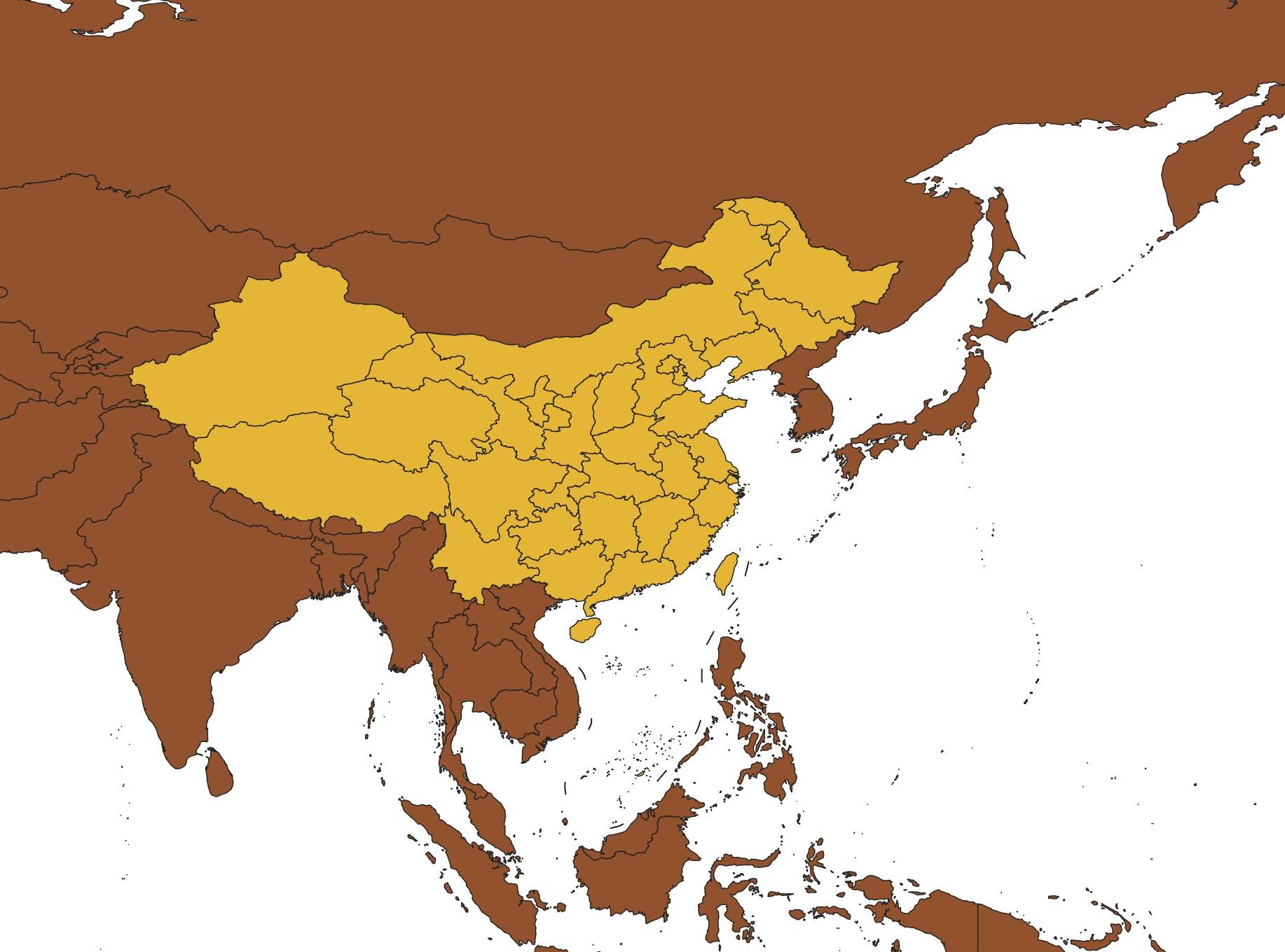
Following our previous article 《「GIS Data」Global Maximum Personal Income Tax Rates for 2023》, many readers requested guidance on visualizing the data. This guide demonstrates a rapid technique to acquire global administrative boundaries using native QGIS functionality - no plugins required.
Note: While remarkably simple, this approach requires boundary verification, particularly for China.
With the rapid development of AI technologies—such as in our earlier article A First Look at Using Segment Anything for GIS and the booming trend of generative AI—many GIS professionals might wonder: is there an AI tool that can help with vectorization tasks? The answer is yes. In this article, we will explore how to use an AI-powered plugin in QGIS to automate vectorization.
Following our previous article 《https://malagis.com/arcgis-pro-3-1-6-installation-problem-solution.html》, we're sharing a community-developed utility that addresses persistent application anomalies. This tool efficiently resets user configurations to resolve multiple operational failures.
Copyright © 2020-2026 MalaGIS Drive by Typecho & Lingonberry Sitemap