Following our previous article 《「GIS Resource」Sharing WMTS Service for Chinese Historical Maps》, many users adopted the historical territory maps. However, those maps lacked contextual historical figures and events. Based on reader recommendations, we present a more comprehensive solution:
About the All history Map
Website: https://www.allhistory.com/map
(Submodule of Allhistory - https://www.allhistory.com)
All history employs AI knowledge graphs to deliver spatiotemporal historical data, creating immersive digital humanities experiences across history, culture, and social sciences.
Key Features
1. Exquisite Global Territory Maps
Unlike the China-focused, paper-based maps previously shared, Allhistory offers aesthetically designed global historical maps with refined color schemes.
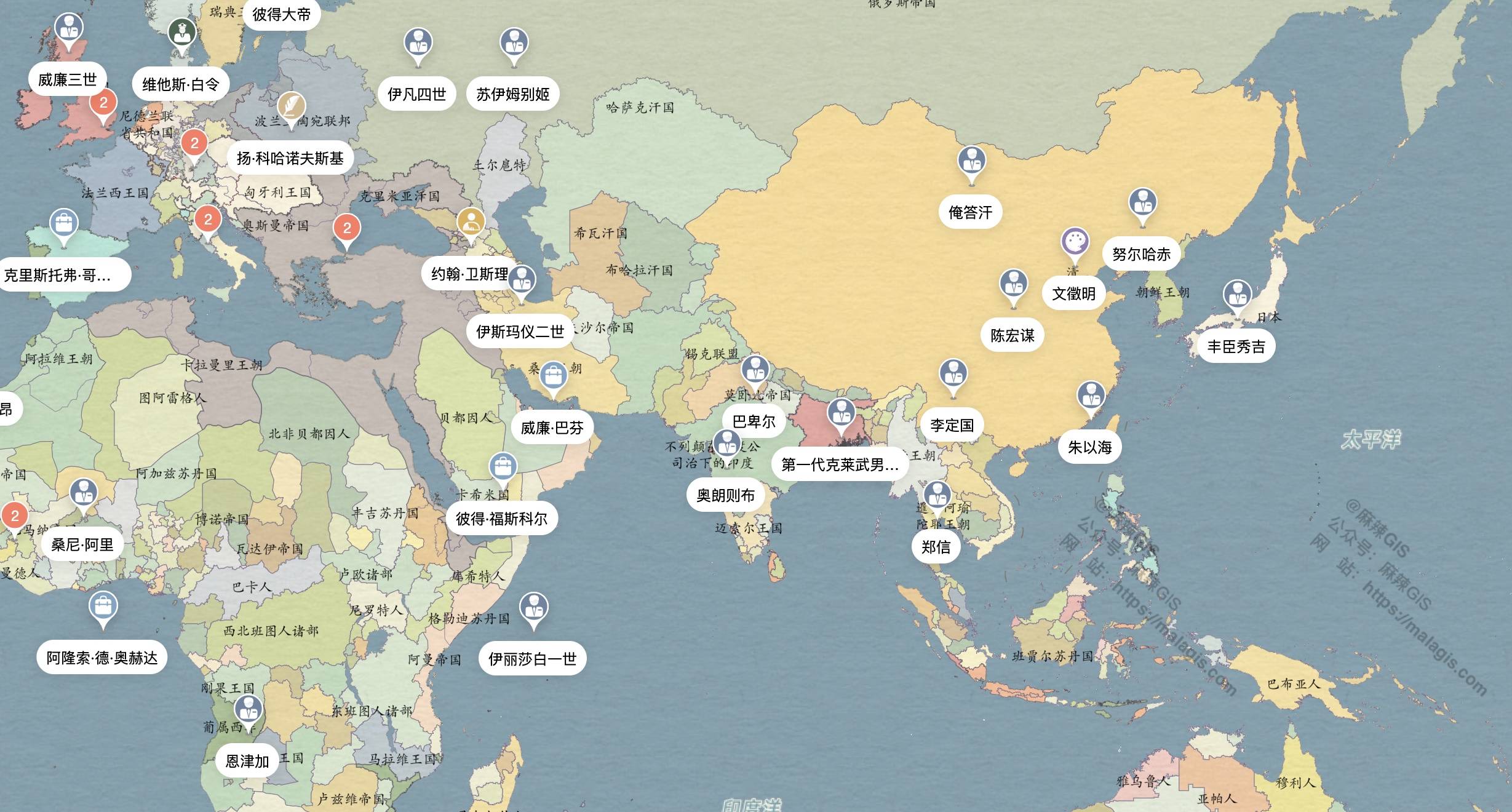
Figure 1: Qing Dynasty global territorial divisions
2. Continuous Timeline
Moving beyond dynasty-based periodization, this platform features a fluid historical timeline. Drag the slider to witness territorial evolution:

Figure 2: Interactive historical timeline
3. Comprehensive Historical Figures
View prominent figures within specific periods, with detailed biographical timelines:


Biographical narratives with geographic context
4. Historical Event Visualization
Explore key events through geospatial representations and detailed chronological breakdowns:


Event analysis with geographic and temporal markers
Limitations
The base map utilizes modern geography, lacking representations of historical geographical changes (e.g., Yellow River capturing Huaihe River, historical coastline evolution). Future updates may address these aspects.
Contributions of additional historical map resources are welcomed.