We're introducing the Global Age Mapping Integration (GAMI) dataset—a high-resolution global forest age distribution resource for 2010 and 2020.
We're introducing the Global Age Mapping Integration (GAMI) dataset—a high-resolution global forest age distribution resource for 2010 and 2020.
Following our previous article 《「GIS Data」Global Maximum Personal Income Tax Rates for 2023》, many readers requested guidance on visualizing the data. This guide demonstrates a rapid technique to acquire global administrative boundaries using native QGIS functionality - no plugins required.
Note: While remarkably simple, this approach requires boundary verification, particularly for China.
We're sharing a valuable 2023 global soil erodibility dataset acquired through complex application procedures. This resource is particularly useful for GIS researchers conducting soil erosion studies.
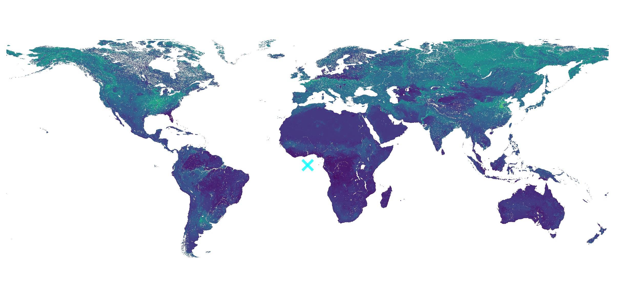
In response to community inquiries regarding forest cover data analysis (e.g., correlation with PM2.5 levels), we present a comprehensive 2020 global forest coverage dataset available through multiple access methods: WMS services, Google Earth Engine (GEE), or direct download.
Following our previous article 《「GIS Tutorial」Visualizing Global Satellites Online》, many readers inquired about accessing raw satellite data for custom visualizations. After extensive research, we've identified a reliable method to obtain comprehensive satellite orbital data.
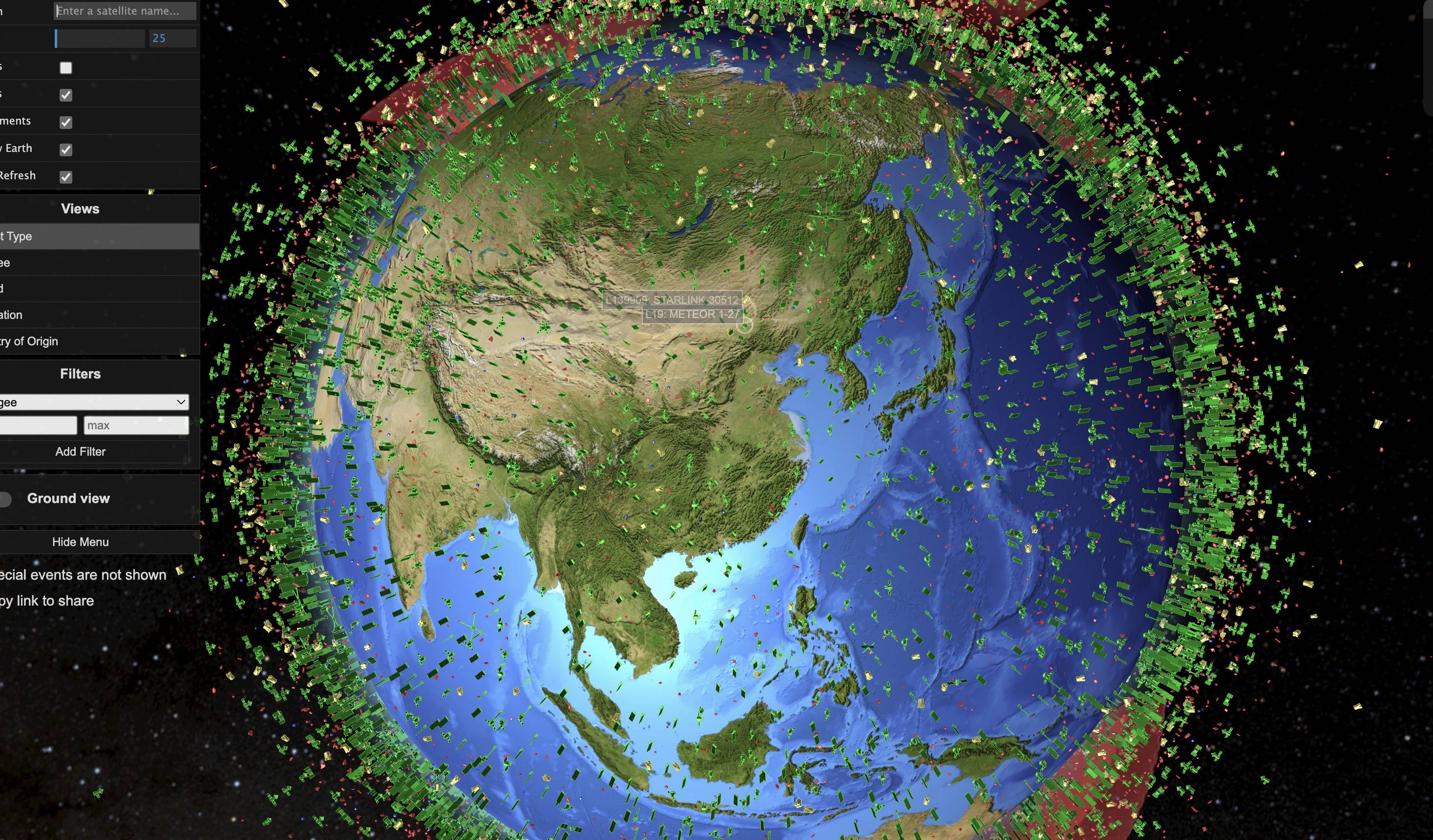
Reference visualization from the original platform
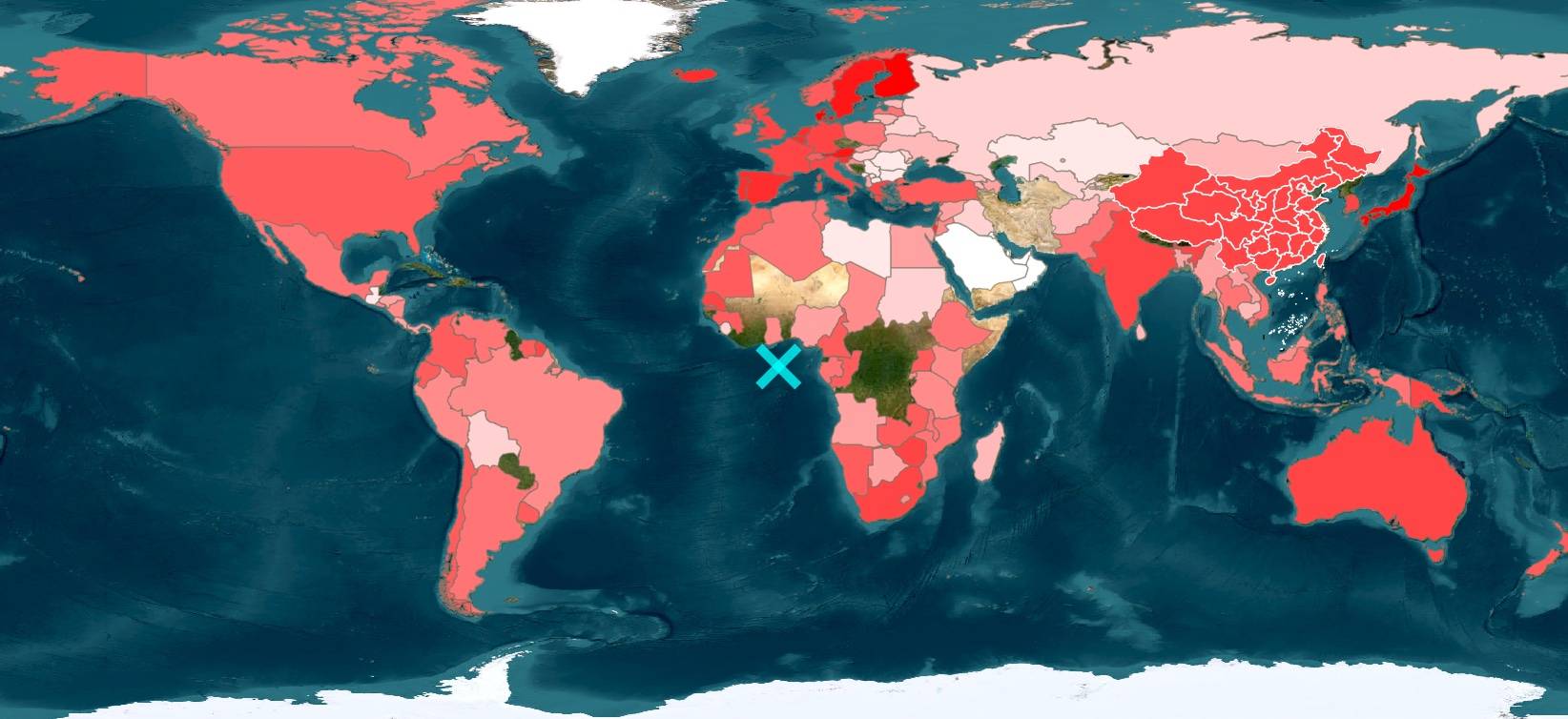
While processing personal income tax returns, I compiled global income tax data into a GIS-compatible CSV format suitable for mapping in ArcGIS or QGIS.
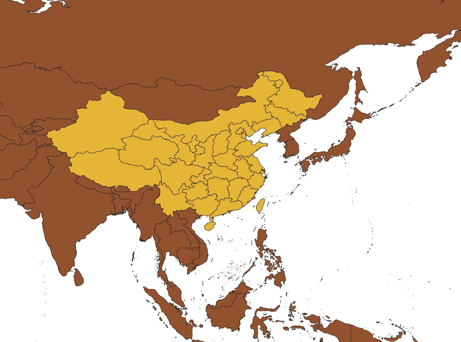
Recently, someone in the Malagis GIS group was looking for historical maps of Chinese dynasties. While a friend from Qingdao shared some high-resolution scanned maps, I remembered seeing an online historical map service maintained by an institute in Taiwan. After asking GPT, I found it again. If you're interested in historical geography, this is a valuable resource.
Copyright © 2020-2026 MalaGIS Drive by Typecho & Lingonberry Sitemap