When working with large SHP boundary files, exporting coordinates of specific district boundaries to TXT is straightforward in QGIS. Here are three approaches:
Method 1: GeoJSON Export
- Open SHP file and select target feature
When working with large SHP boundary files, exporting coordinates of specific district boundaries to TXT is straightforward in QGIS. Here are three approaches:
This article summarizes common Python GDAL code snippets for geospatial data processing. GDAL (Geospatial Data Abstraction Library) is a foundational library for handling raster and vector geospatial data, maintained by the Open Source Geospatial Foundation (OSGeo). Implemented in C/C++, it provides Python, Java, and other language bindings. When calling GDAL's API in Python, the underlying execution relies on compiled C/C++ binaries.
GDAL Official Site: https://gdal.org/
Python API Documentation: https://gdal.org/api/index.html#python-api
Many readers have requested software resources for Global Mapper Pro. As I rarely use this software personally, updates were infrequent. Recently, my article "How to Download Online GIS Map Services for Local Use?" covered methods for downloading WMTS and other map services, with several users recommending Global Mapper Pro. Out of curiosity, I researched Global Mapper Pro resources and discovered three recent versions (v24, v25, v26). I'll share these incrementally in future posts.

I've frequently seen peers inquire about entering GIS development. Though still refining my own expertise, my journey from computer novice to professional developer offers insights worth sharing. This article outlines a goal-oriented approach that helped me navigate the field – perhaps it will resonate with you too.
Note: These are personal experiences, not universally replicable formulas.
During a recent ArcGIS session, my team lead asked:
"Where are ESRI's servers located?"
"Probably in the US," I replied instinctively.
"That means signals from Wuhan travel quite a distance!"
This sparked my curiosity: Could we visualize this network path?
This tool enables rapid network path visualization. See sample output: 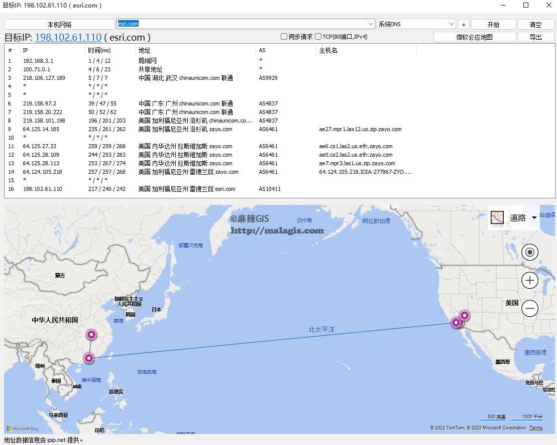
During development of a grid management system, I initially planned to use PostgreSQL for storing grid WKT data (for direct SHP export and map service publishing). Due to incompatibility with backend framework requirements, I switched to MySQL. This necessitated converting MySQL-stored WKT to Shapefiles. The solution: Java scheduled tasks invoking Python scripts to automate conversion. Below are the code implementations.
Preview: 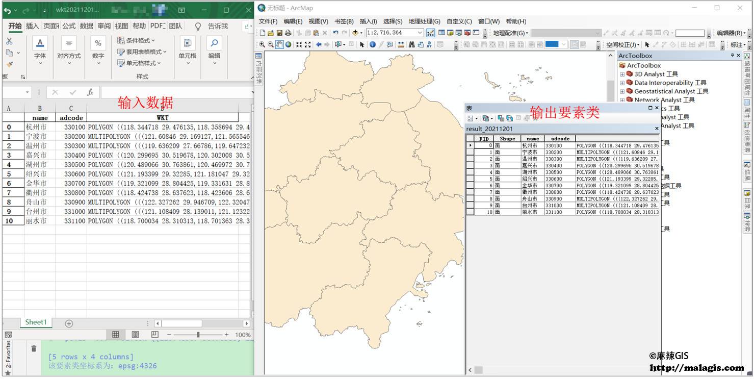
Many GIS students inadvertently purchase MacBook only to discover that ArcGIS and most domestic GIS software lack macOS versions. This article summarizes solutions for running ArcGIS on M1 Macs. Better approaches are welcome in the comments.

Yesterday in a technical group, an interesting question arose: How does Leaflet's official website achieve its smooth leaf logo color transition? While initially assuming it was a GIF animation, closer inspection revealed a more elegant solution.

Air quality monitoring typically generates hourly or daily data, while environmental remote sensing research often requires long-term data aggregation and comparison. This guide provides a programming-free method for researchers to efficiently consolidate and analyze such datasets.
Hourly air quality data (AQI, PM~2.5~, PM~10~, SO~2~, NO~2~, O~3~, CO) is available from Wang Xiaolei's authoritative platform:
https://quotsoft.net/air/
Dataset Coverage:
Beijing municipal stations (35 sites across categories):

National station distribution
Copyright © 2020-2026 MalaGIS Drive by Typecho & Lingonberry Sitemap