MalaGIS

Sharing GIS Technologies, Resources and News.

Cesium Mars: A Unified High-Precision Digital Base for Mars Visualization and Simulation

Last year, our team introduced how to load lunar datasets in Cesium. Now, one year later, Cesium has officially begun supporting the Mars dataset—Cesium Mars. Cesium Mars is a 3D Tileset designed to enable developers and researchers to quickly create visualizations and simulations of Mars. The dataset integrates laser altimeter data (MOLA) from NASA's Mars Global Surveyor (MGS), high-resolution stereo camera imagery (HRSC) from ESA's Mars Express, and color satellite image rendering, realistically recreating the visual appearance of Mars.

more >>

three-tile: A Lightweight Frontend 3D Tile Map Development Framework

In a previous article "Maptalks: An Open-Source Alternative to Cesium for Geospatial Visualization", we introduced maptalks as an alternative framework to Cesium. Recently, we discovered another open-source 2D/3D engine: three-tile. Designed for lightweight implementation with ongoing functional improvements, it already meets significant development demands. Here is a brief introduction.

more >>

Geospatial Data Harvesting: Using Grok AI to Map Li Ka-shing's Sold Ports for Cesium Visualization

The recent sale of 43 global ports by Li Ka-shing—including two along the Panama Canal—has drawn international attention. I attempted to develop an interactive Cesium visualization showing these ports' geographic distribution, but news reports only mentioned quantities without specific coordinates. This required manual data collection.


PS: Video demonstration available on MalaGIS Video Channel.

more >>

Implementing Lightweight Choropleth Mapping with Colormap.js

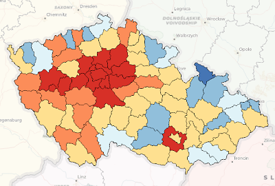
When creating thematic maps in ArcGIS or QGIS, thematic coloring (choropleth mapping) is a common technique where different regions are colored according to their data values, revealing spatial patterns. Recently, our management requested integrating this functionality into our business system. While we could publish pre-rendered maps from ArcGIS/QGIS through servers like GeoServer, this lightweight feature doesn't warrant heavy infrastructure. Instead, I explored coloring GeoJSON features directly and discovered colormap - an elegant solution.

more >>

How the Renaming of the Gulf of Mexico Impacts the GIS Industry

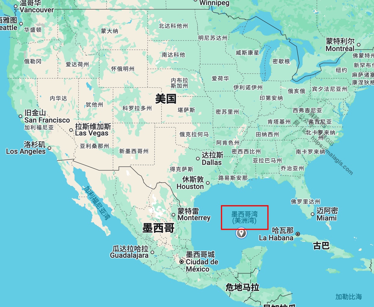
Since U.S. President Donald Trump's executive order on his first day in office renamed the Gulf of Mexico to the "Gulf of America," the ripple effects have begun to spread. Recent reports indicate that major map service providers like Google Maps have already followed suit. But how does this change affect GIS professionals in China, and how should we respond? This article provides a brief analysis.

Updates from International Map Services

After reviewing services like Google Maps, Bing Maps, OpenStreetMap, and Cesium, here’s a summary of how each platform is handling the name change.

Google Maps

Google Maps was one of the first to react. Here's how it looks now:

more >>

Implementing Custom Basemaps in CesiumJS: Eliminating Cesium Ion Dependency

Following our guide on https://malagis.com/qucik-build-a-cesium-study-example.html, this article addresses limitations of Cesium Ion—particularly accessibility challenges for Chinese users—by demonstrating alternative basemap integration methods.

Understanding ImageryLayers

The ImageryLayers class manages map imagery display in CesiumJS, enabling:

  • Multi-layer overlays (satellite imagery, custom maps)
  • Layer ordering control
  • Transparency/visibility adjustments

more >>

Pre-rendered Global Basemaps for Simplified Geovisualization

For global-scale visualizations (e.g., GDP distribution maps), complex tile services like WMTS/WMS are often unnecessary. ECharts-GL provides six high-quality static basemaps—including Earth and lunar datasets—that offer lightweight alternatives to conventional tile services. These pre-rendered images work seamlessly with Cesium, Leaflet, and other mapping frameworks.

Complementary resource: https://malagis.com/share-world-map-vector-data-shp-from-gaode-map.html

more >>

Implementing Cesium in Legacy WebGIS Projects: Overcoming Node Version Constraints

When integrating Cesium into a legacy UMI3-based WebGIS project, Node version compatibility issues arose due to Cesium's requirement for Node ≥18.18.0. Direct Node upgrade would trigger extensive regression testing, making alternative deployment approaches necessary.

more >>

Comparative Evaluation of Public CDN Resources for CesiumJS Deployment

When deploying CesiumJS projects, the library's substantial size (~100MB) often slows CI builds. This analysis evaluates domestic CDN options for external Cesium loading to optimize deployment efficiency without compromising functionality.

more >>

Maptalks: An Open-Source Alternative to Cesium for Geospatial Visualization

Following Bentley Systems' acquisition of Cesium and its increasing commercial integration, GIS professionals are exploring alternative open-source solutions for 3D geospatial projects. Maptalks emerges as a viable option, particularly for projects requiring domestic innovation ecosystem compliance.

more >>

Copyright © 2020-2025 MalaGIS Drive by Typecho & Lingonberry Sitemap

Back to top