MalaGIS

Sharing GIS Technologies, Resources and News.

QGIS 4.0 Roadmap Unveiled: Major Qt6 Migration Scheduled for October Release

The QGIS development team has officially announced plans for QGIS 4.0, with an expected release in October 2025 following QGIS 3.44. This major update centers on modernizing the platform's core infrastructure.

more >>

Gary Sherman: The Godfather of Open-Source GIS and the Birth of QGIS

Recently in the MalaGIS discussion group, we debated the seemingly stagnant development of GIS and the career paths for GIS professionals. Honestly, I too feel uncertain. Coincidentally, I came across a 2018 interview with the founder of QGIS. I've translated it below, hoping it offers insight to readers.

more >>

Implementing Lightweight Choropleth Mapping with Colormap.js

When creating thematic maps in ArcGIS or QGIS, thematic coloring (choropleth mapping) is a common technique where different regions are colored according to their data values, revealing spatial patterns. Recently, our management requested integrating this functionality into our business system. While we could publish pre-rendered maps from ArcGIS/QGIS through servers like GeoServer, this lightweight feature doesn't warrant heavy infrastructure. Instead, I explored coloring GeoJSON features directly and discovered colormap - an elegant solution.

more >>

23 Years of QGIS: The Open-Source Revolution That Reshaped GIS

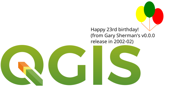
While updating to QGIS 3.40.3, I stumbled upon a surprising fact: QGIS is now 23 years old – possibly older than many of its users. It’s remarkable that this powerful open-source GIS software, used worldwide for mapping, data processing, and service publishing, was born in the dial-up internet era. Since Gary Sherman wrote its first line of code in Germany in 2002, QGIS has quietly revolutionized spatial technology for 23 years. Debuting five years before the iPhone and thirteen years before TensorFlow, this open-source GIS has not only survived three technological earthquakes (the dot-com crash, mobile revolution, and AI explosion) but evolved from a basic map viewer into global geospatial infrastructure. Let’s journey through time to uncover how this "living tech fossil" defied commercial giants to become king.

more >>

Sketch Annotation in QGIS: A Guide to Red Layer Plugin

Red Layer is a sketch annotation plugin for QGIS 3 that enables rapid hand-drawn annotations directly on your map canvas. A sample output is shown below:

more >>

Mastering Vector Curves: A Comprehensive Guide to QGIS Bezier Editing Plugin

Bezier Editing is an open-source plugin for QGIS that specializes in precision vector graphic editing, particularly suited for complex curve design scenarios like roads, rivers, and landscape boundaries. By introducing Bezier curve control points, it transforms rigid polylines into smooth, natural curves, significantly enhancing both cartographic aesthetics and data accuracy.

more >>

A GIS Valentine: Bonne Projection and Drawing from the Heart

Valentine’s Day is here again, and the GIS community group at Malagis is buzzing with excitement. Watching the lively discussions makes one nostalgic for youthful enthusiasm. On such a romantic day, shouldn't everything—including GIS—have its own charm? Let’s explore two GIS-inspired romantic ideas shared by the group.

1. The Bonne Projection

Do you still remember the Bonne projection? Or have your cartography lessons faded into memory? Here's what it looks like:

more >>

Accessing Pre-Vectorized Trail Data from China's Outdoor Platform: Two Step Road

Building upon our previous tutorials on 《Creating Dynamic Marathon Route Visualizations with MapPlus: A No-Code GIS Solution》 and 《Implementing Dynamic Marathon Route Visualization with Cesium》, this guide introduces a solution for users seeking pre-processed trajectory data without manual digitization.

Introducing Two Step Road Platform

Official Website: https://www.2bulu.com/

more >>

Creating Marathon Distribution Heatmaps in QGIS

Following our previous article on Processing China Marathon Data for Spatial Analysis, this guide demonstrates heatmap visualization of marathon venues using QGIS.

more >>

Georeferencing Marathon Route Maps in QGIS: Manual vs. AI-Assisted Approaches

When crafting dynamic marathon routes from official maps, directly tracing simplified route images is inefficient without proper spatial referencing. Georeferencing solves this by aligning raster images with real-world coordinates.

more >>

Copyright © 2020-2025 MalaGIS Drive by Typecho & Lingonberry Sitemap

Back to top